Home
About Us
Projects
Our Services
Blog
Branches
Contacts
Home
About Us
Projects
Our Services
Blog
Branches
Contacts
GIS (Geographical Information Systems)
Home
portfolio
GIS (Geographical Information Systems)
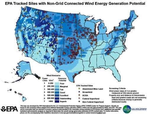
Carrying of GIS survey and representation of Critical flood areas in Margao.
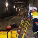
Underground survey, soil investigation & testing
Aerial Survey (Drone)
Related Projects